Popis
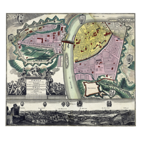
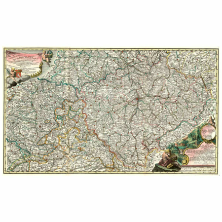
Seutter, Georg Matthäeus [Jiří Matyáš]: Mapa Prahy s okolím.
Stará mapa.
Kolorovaná mědirytina, nedatováno [kolem roku 1757], grafické měříko [cca 1:84 800], výška 560 mm, šířka 490 mm.
Georg Matthäeus Seutter (1678 Augsburg – 1756/1757 Augsburg) byl mědirytcem a nakladatelem v Augsburku. Pocházel z rodiny zlatníků a pivovarníků, rytcem map se vyučil u věhlasného kartografického nakladatele Johanna Baptisty Homanna v Norimberku a poté působil v různých německých nakladatelstvích. Své vlastní nakladatelství založil roku 1707 a zaměřil se na vydávání map a atlasů. Kromě Homannova norimberského nakladatelství patřila Seutterova firma k nejvýznamnějším kartografickým dílnám 18. století. Po jeho smrti převzal část tiskových měděných desek jeho zeť Tobias Conrad Lotter a vedl nakladatelství dále pod svým jménem. Seutterova mapa Prahy a okolí znázorňuje území, které se svým rozsahem blíží současné rozloze města Prahy. Praha je zachycena plnými půdorysy tehdejších čtyř samostatných měst, Starého Města s Židovským Městem, Nového Města, Malé Strany a Hradčan. Město obklopuje barokní opevnění s branami, zakreslen je Karlův most a pevnost Vyšehrad. Vojenská tematika, děla, prapory, puška a válečné bubny zdobí titul v pravém dolním rohu listu. Mapový obraz je velmi jednoduchý a stylizovaný. Do mapového rámu vložil autor zeměpisnou síť, do levého horního roku umístil znaky pražských měst a Vyšehradu.
© Historický ústav Akademie věd ČR, Praha.Georg Matthäus Seutter – Prague and its Surroundings (around 1757)
Historical map.
Seutter, Georg Matthäeus [Jiří Matyáš]: Prague and its Surroundings. Coloured copper-engraving, undated [around 1757], graphic scale [cca 1:84 800], height 560 mm, width 490 mm.
Georg Matthäeus Seutter (1678 Augsburg – 1756/1757 Augsburg) was a copper engraver and publisher in Augsburg. He came from a family of goldsmiths and brewers, and learned his trade as a map engraver with the celebrated cartographic publisher Johann Baptista Homann in Nuremberg. He later worked for various German publishing houses. He founded his own publishing house in 1707 and focused on the publishing of maps and atlases. Alongside Homann’s Publishing House in Nuremberg, Seutter’s firm was among the most important cartographic workshops of the 18th century. After his death his son-in-law Tobias Conrad Lotter took over some of his copper plates and led the publishing house under his own name.
Seutter’s map of Prague and its surroundings depicts a territory corresponding roughly to the present territory of the City of Prague. Prague is depicted in full lay-outs of the four independent towns that then made up the city: the Old Town with the Jewish Town, the New Town, the Lesser Town and Hradčany. The city is encircled by Baroque fortification walls with gates, Charles Bridge and the Vyšehrad fortress are drawn in. Military themes, cannon, banners, a gun and war drums adorn the title in the right lower corner of the leaf. The map image is very simple and stylised. The author has inserted a geographical grid into the map frame and has placed the coats of arms of the Prague towns and Vyšehrad in the left upper corner.
© Historický ústav Akademie věd ČR, Praha.
![Seutter, Georg Matthäeus – Mapa Prahy [1757]](https://www.ateliermanufactura.com/wp-content/upLoads/Seutter-Pragae-Bohemiae.jpg)
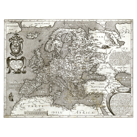
![Seutter, Georg Matthäeus - Mapa Prahy [1757]. Tisk formátu A3.](https://www.ateliermanufactura.com/wp-content/upLoads/1011737-1.jpg)
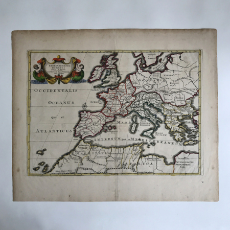
![Seutter, Georg Matthäeus - Mapa Prahy [1757]. Tisk formátu A3.](https://www.ateliermanufactura.com/wp-content/upLoads/1011738-1.jpg)
![Seutter, Georg Matthäeus - Mapa Prahy [1757]. Tisk formátu A5 (složený arch A4) a obálka C5.](https://www.ateliermanufactura.com/wp-content/upLoads/1012152-3.jpg)
![Seutter, Georg Matthäeus – Mapa Prahy [1757]](https://www.ateliermanufactura.com/wp-content/upLoads/Seutter-Pragae-Bohemiae-100x100.jpg)
![Seutter, Georg Matthäeus - Mapa Prahy [1757]. Tisk formátu A3.](https://www.ateliermanufactura.com/wp-content/upLoads/1011737-1-100x100.jpg)
![Seutter, Georg Matthäeus - Mapa Prahy [1757]. Tisk formátu A3.](https://www.ateliermanufactura.com/wp-content/upLoads/1011738-1-100x100.jpg)
![Seutter, Georg Matthäeus - Mapa Prahy [1757]. Tisk formátu A5 (složený arch A4) a obálka C5.](https://www.ateliermanufactura.com/wp-content/upLoads/1012152-3-100x100.jpg)
