
Homann – Map of Europe.
Johann Baptista Homann – Map of Europe
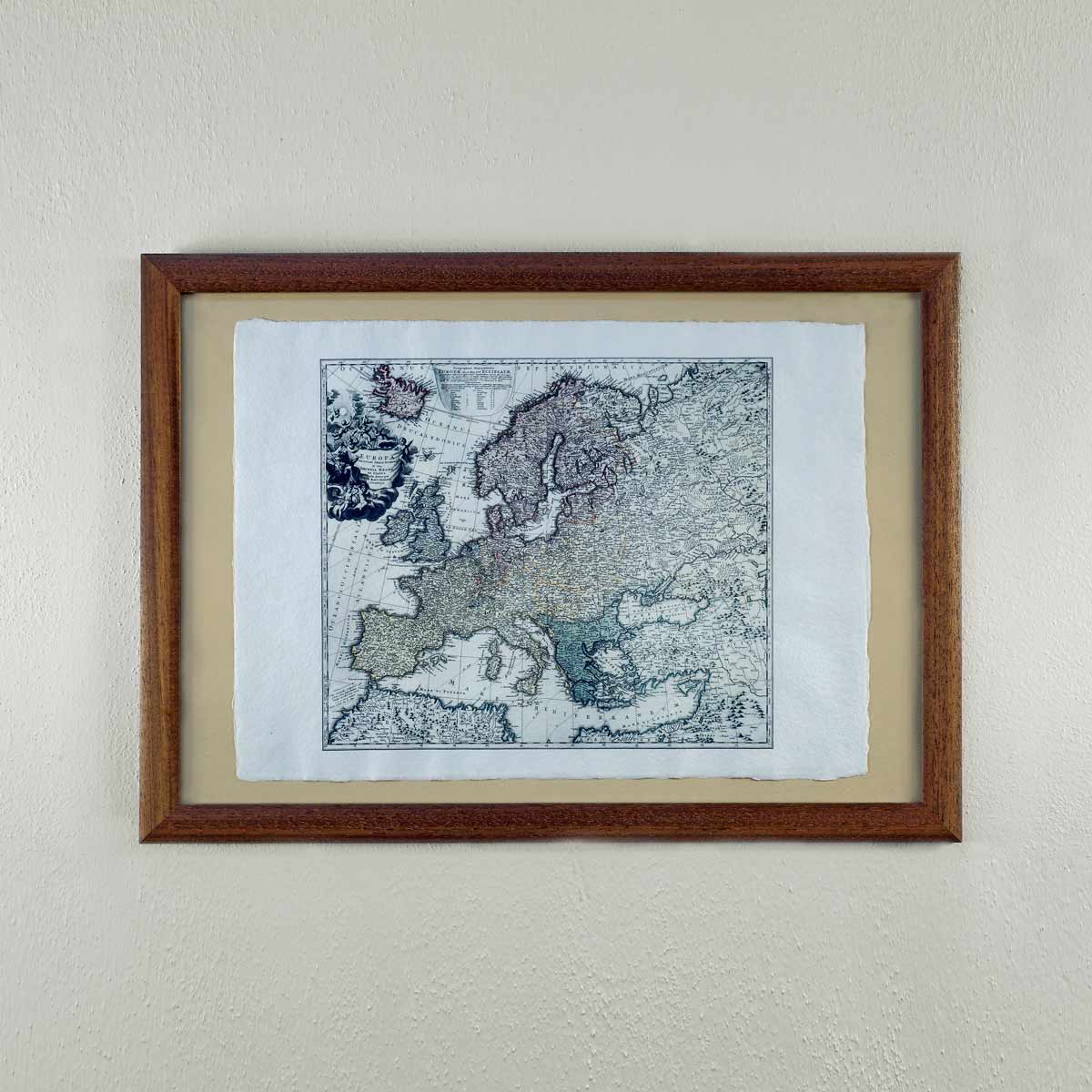
Map of Europe. Coloured copper-engraving, undated [1714], without scale [cca 1:10 000 000], height 460 mm, width 560 mm. Johann Baptist Homann (1664 Oberkammlach-1724 Nuremberg) was one of the most famous cartographers, geographers and publishers of the 18th century. From 1692 he worked as a copper engraver, in 1702 he founded his own works in Nuremberg and as early as 1710 he published his “Atlas novus” (Neuer Atlas) with forty maps. Homann created most of the maps using Dutch and French models. The map of Europe including parts of Asia Minor, North Africa and part of Russia is inserted in a geographical grid and contains a very detailed topography. The North Pole is marked off with a double line (circulus arcticus). The title in a cartouche in the left upper corner of the map is adorned by putti and a seated woman – an allegory of Europe as queen of the Christian world. The Bohemian Lands, which at that time belonged to the Habsburg Empire, are not marked out in colour on the map.
Leave a Reply
Want to join the discussion?Feel free to contribute!